

People with chronic pain conditions such as Multiple Sclerosis (MS), Long COVID, and Arthritis, face significant challenges when navigating unfamiliar public transit systems. These challenges stem from inconsistent accessibility features, unclear infrastructure, and a lack of real-time support. While accessibility-focused travel apps exist, few address the full complexity of international travel for people with fluctuating or energy-limiting conditions.
Cotrace is a mobile app designed to bridge this gap, empowering users with personalized transit navigation, accessibility filters, and location-aware support tools to make independent travel more manageable and less stressful. Features including low-strain routes, climate-friendly navigation, and accessibility settings can be tailored to individual needs. Real-time transit updates and step-free directions reduce uncertainty, while color cues and ample whitespace create a calming, user-friendly interface.
The goal was to create a logo that represents unity and connectedness. The interaction of the "C" and "O" suggests a route marker, symbolizing guidance and movement. Soft curves bring warmth and approachability, reflecting the app's support for its users.


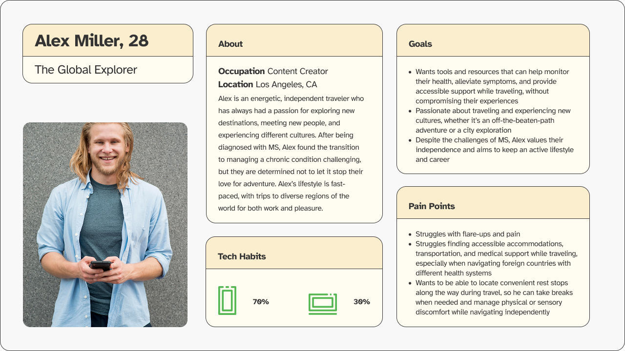
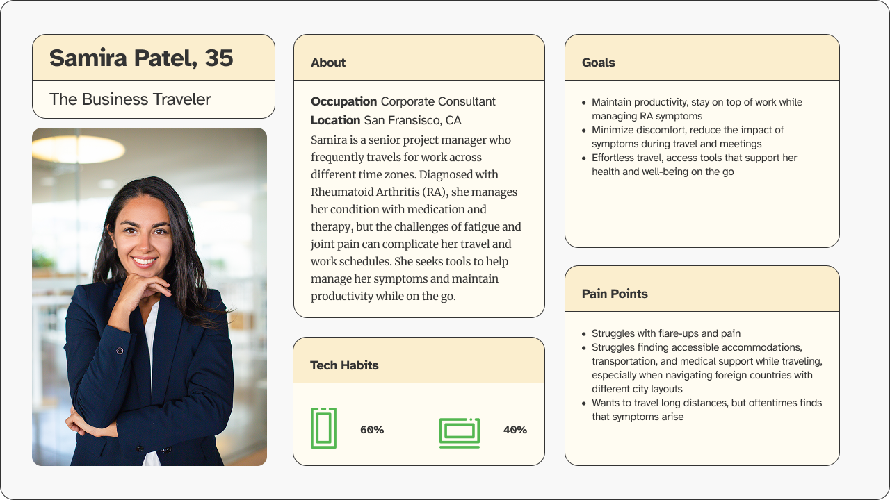
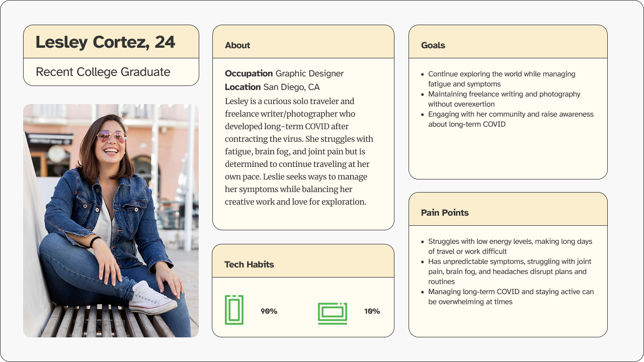
To design Cotrace with empathy, user personas reflect travelers with cognitive and physical challenges. Their needs shaped features like real-time alerts, low-strain routes, and accessible trip planning. It is a tool for navigating transit with confidence and independence.
The Site Map outlines the app's core structure, including onboarding, trip planning, navigation, preferences, and support, ensuring a seamless flow from setup to real-time travel assistance.


The onboarding experience is user-centric, intuitive, and accessibility-focused. Users are gently guided through personalized setup based on their mobility needs, transit preferences, and comfort levels.


With a clean, step-by-step interface, users can select their preferred mode of transport and get real-time updates on travel times, delays, nearby options, and accessibility features, making it easier to navigate unfamiliar systems with confidence.


